

US Border Logistics Briefing - October 9, 2026
Prepared 6:00 AM PDT
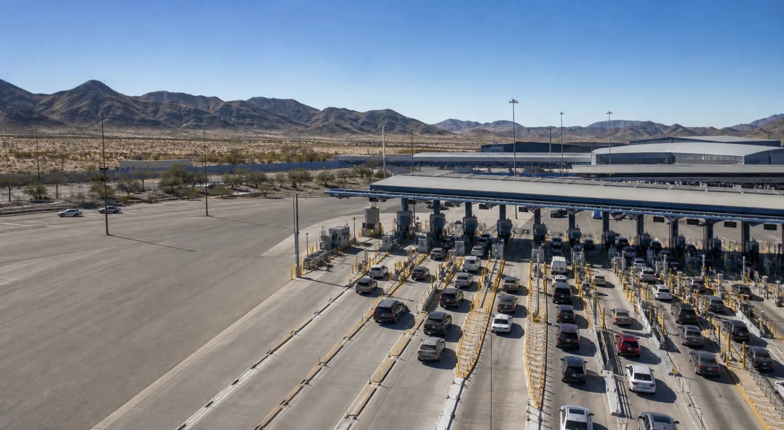
Border-crossing conditions are quiet in the active wait-time feed this morning, but the absence of live lane readings should not be mistaken for broad relief. The latest CBP/CBSA pull is fresh at 12 minutes old, yet it contains no active wait-time data in the last two hours, so today’s operating picture is being driven more by weather, airport constraints, and policy releases than by measured queue pressure. For logistics teams, that means the immediate risk is less about a documented line spike and more about monitoring for localized disruption where weather and facility conditions overlap with cross-border routings.
The most material operational signals are concentrated in the Southwest, where heat and wind products remain in force, and in Southern California, where coastal hazards are layered onto the airport picture. There is also a notable temperature reading at International Falls showing freezing at -0.2°C, a reminder that conditions are not uniform across the border network even though the current live queue file is empty. Against that backdrop, the trade-policy docket remains active with multiple notices dated October 8 and 9, but those items are claim caveated and should be treated as context only unless corroborated through formal policy review.
The working takeaway for dispatch and brokerage is straightforward: there is no current measured border-delay event in the supplied feed, but there are enough peripheral disruptions and policy developments to justify close watch on cross-border freight planning today. The most useful next checks are any fresh wait-time postings, continued aviation closure status in San Diego, and whether the weather products expand into corridors that feed mainline trucking or airport-dependent cargo movements.
Crossing Delays and Lane-Level Conditions
No active wait-time data were posted in the last two hours, so there are no current lane-level delay figures to report from today’s border pull. That lack of live readings matters operationally because it prevents a normal comparison of standard versus cargo or passenger lane performance at any individual port of entry. In other words, there is no evidence in the current feed of congestion improvement or deterioration; the cause of the missing data is not identified in current feeds.
The only crossing-adjacent weather signal in the raw conditions feed is at International Falls, where temperature is reported at freezing, -0.2°C. That is not a delay report, but it is a practical operating indicator for northern-border monitoring because it confirms below-freezing conditions on a route that can matter for equipment performance and road treatment decisions. No lane-specific impact was provided with that observation.
Significant 24-Hour Changes
The clearest change over the past day is on the weather side rather than in queues. Extreme Heat Warnings were issued by NWS Phoenix AZ on October 8 at 11:18 PM MST and remain valid until October 9 at 8:00 PM MST; the alert appears twice in the feed, but the underlying warning is the same. NWS Tucson AZ also issued a Wind Advisory on October 8 at 10:39 PM MST, valid until October 11 at 11:00 PM MST. Phoenix additionally has a Wind Advisory issued at 11:18 PM MST on October 8, valid until October 11 at 5:00 PM MST, also duplicated in the feed. These are important because they indicate a sustained weather envelope over key Southwest freight corridors, though the data does not provide direct roadway closure or border-lane impacts.
Southern California conditions also remained active overnight. NWS San Diego CA issued a Beach Hazards Statement on October 9 at 2:12 AM PDT, valid until October 9 at 11:00 PM PDT, and a second Beach Hazards Statement from October 8 at 9:12 PM PDT through the same expiration time. While beach hazards are not a freight-delay metric on their own, they show persistent coastal weather activity affecting the region surrounding San Diego’s port and airport complex.
Trade Policy Documents and Claim Caveats
The policy docket is busy, but the supplied items are explicitly raw-current policy-document context only and must not be treated as normalized policy facts or legal advice. Several notices are dated October 9, 2026, including the International Trade Commission’s scheduling of full five-year reviews for phosphate fertilizers from Morocco and Russia, an ITC notice not to review an initial determination terminating the DRAM devices investigation based on settlement, and an ITC notice of vacatur and mootness in the hydrodermabrasion systems matter due to patent expiration. Commerce also posted preliminary results on certain paper shopping bags from Cambodia and passenger vehicle and light truck tires from Thailand, as well as final results for certain hot-rolled steel flat products from the Republic of Korea.
The October 8 docket adds further policy context with USTR’s request for comments on the effect of the European Union’s Carbon Border Adjustment Mechanism and proposed coverage expansions on U.S. trade, an ITC cancellation of hearing for forged steel fittings from India and South Korea, a Commerce final affirmative determination on chromium trioxide from Türkiye, and an ITC institution notice involving certain mobile electronic devices and components. Operationally, these items matter because they can affect trade compliance planning, but the feed itself does not establish immediate border-delay consequences. No inference should be made about lane conditions or inspection intensity from these notices alone.
Aviation and Airport Conditions
The aviation signal in the feed is specific and restrictive at San Diego International. FAA reports a closure: “SAN AD AP CLSD TO NON SKED TRANSIENT GA ACFT EXC PPR 619-298-7704 2610011633-2701010800.” In practical terms, that means SAN is closed to non-scheduled transient general aviation aircraft except with prior permission required. The notice is dated to remain in effect through January 1, 2027 per the encoded validity in the advisory. The supplied data does not say whether scheduled commercial operations are affected, so that should not be assumed.
For logistics users who depend on air cargo connections, this is a facility constraint worth tracking even if it is limited to transient GA. It can affect ad hoc flight planning, charter flexibility, and any operations that rely on unscheduled aviation movements through the San Diego area. No additional FAA delay figures were provided.
Weather Alerts and Notable Crossing Conditions
Weather is the most active non-policy risk in today’s packet. Extreme Heat Warning coverage in Phoenix runs through 8:00 PM MST today, while wind advisories extend longer in both Phoenix and Tucson, with Tucson’s advisory lasting until November 11 at 11:00 PM MST and Phoenix’s until November 11 at 5:00 PM MST. The duplication of the Phoenix and beach-hazard alerts appears to be a feed artifact rather than multiple distinct hazards, so the underlying operational message is the same: sustained weather awareness is needed rather than episodic reaction.
The freeze reading at International Falls, -0.2°C, is the only directly observed crossing-condition datapoint in the feed. No accompanying delay, road status, or lane restriction was supplied, so it should be treated as a diagnostic condition rather than a claim of disruption. Still, it is a useful reminder that the northern border is already at or below freezing even as Southwest heat dominates the alert structure.
Community Intelligence
There is no community intelligence in the supplied data to treat as live evidence. No retired, raw, or diagnostic community reports were provided for use as corroborating support, so this section remains empty by necessity.
Macro and Economic Indicators
The macro backdrop remains mixed and, in places, expensive for transport operators. Brent crude is reported at 125.44 as of 2026-10-06, with WTI at 96.24 on the same date, keeping fuel-cost pressure relevant for long-haul trucking and cross-border moves. Diesel indicators are elevated: US Diesel Retail is 6.20 as of 2026-10-05, with regional diesel series at 5.82 for GASDESGCW, 6.29 for GASDESMWW, and 7.23 for GASDESWCW, all as of 2026-10-05. Those readings matter because they affect linehaul cost sensitivity even when border queues are not currently documented.
Currency and trade-weighted measures also remain important for import/export planning. USD/CAD is 1.4253 and USD/MXN is 18.1920, both as of 2026-10-02, while the Trade Weighted Dollar is 121.38 on the same date. These values do not by themselves indicate a border disruption, but they frame the cost and pricing environment for cross-border freight. BOPGSTB is -57,347.00 as of 2026-02-01, and several producer-price indicators remain elevated: PCU484121484121 at 207.64, PCUOMFGOMFG at 279.70, and PPIACO at 287.93, all as of 2026-08-01. TOTALSA is 16.38 as of 2026-09-01. Because the observation dates vary, the data should be read as a staggered macro backdrop rather than a single synchronized snapshot.
Outlook and Operational Watch List
Near term, the border itself looks data-light rather than congested: there are no active wait-time postings in the last two hours, and the source is fresh. The more actionable watch items are weather persistence in the Southwest, the San Diego aviation restriction, and any new lane postings that might emerge after the current reporting gap. If live waits resume, operators should compare them against the weather window first, because that is the clearest current external stressor in the packet.
- Monitor for the first posted wait times at any port of entry, since today’s queue feed is currently blank.
- Watch Phoenix and Tucson corridors for heat and wind impacts through the weekend.
- Track San Diego airport status for any change in the transient GA closure notice.
- Keep an eye on International Falls for any further cold-weather operational signals.
- Treat the trade-policy notices as context only until formal policy analysis is completed.